photo credit: William McAllister / Pexels
Key Takeaways
- Tides influence water depth, current strength, and access to key fishing areas.
- Incoming and outgoing tides affect where fish position themselves throughout the day.
- Slack tide provides a brief window of reduced current for repositioning and strategy changes.
- Accurate, location-specific tide predictions are essential for effective trip planning.
- Understanding local tidal patterns improves both fishing success and on-water safety.
Robert Post of Woodland Park, NJ, is the president of W.J. Post Inc., a New York City-based mechanical, HVAC, and plumbing contractor with a long record of service across major industries and municipalities. With more than 30 years of professional experience and deep involvement in marine sports, Robert Post brings a practical, experience-driven perspective to outdoor pursuits such as saltwater fishing. A certified welder, HVACR-licensed professional, and longtime member of Pipefitters Local 274, he has also earned recognition in competitive fishing and boating events.
His firsthand knowledge of coastal conditions and time on the water informs a clear understanding of how environmental factors, including tides, influence fishing access, safety, and overall success.
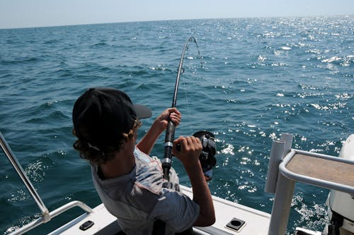
How Tides Affect a Day of Saltwater Fishing
On many coasts, tides decide when a shallow flat becomes reachable and when the current runs strongest through an inlet or channel. In this context, “affect” refers to how tidal stages influence access, water movement, fish positioning, and arrival timing. A tide is the regular rise and fall of ocean water levels created mainly by the moon’s gravity, with the sun adding a secondary influence.
An incoming or flood tide brings water inland and raises the level, while an outgoing or ebb tide lowers it as water flows back toward the open ocean. Unlike a pond, tidal water moves horizontally as levels change, creating stronger and weaker currents in channels, inlets, and along shorelines. Those shifts in current can alter where water funnels through narrow passages and along the structure.
During the rising phase, water spreads across previously exposed flats, rocks, and marsh edges. Previously exposed areas become covered again, and shoreline depth increases quickly. A shore angler may see water creeping into the grass or around jetty stones that were dry earlier. On shallow flats, rising water can quickly change which edges remain within casting range and how far water extends across the interior.
Once the tide turns and begins to fall, water drains off flats and sandbars toward deeper channels, sometimes forming visible seams where foam or debris collects. Anglers call these seams current lines, meaning the surface boundary where flows meet. Depth transitions and narrow cuts often become natural flow paths during the ebb, concentrating moving water into smaller lanes.
Beyond fish positioning, tide height also sets the day’s access limits. High tide brings the maximum water level in the cycle, while low tide brings the minimum and can expose oyster beds, sandbars, and shallow sections of channel that were safely covered hours earlier. At peak high tide, more structure sits under water, which can affect boat clearance around docks, bridges, and rocks.
Between incoming and outgoing stages lies slack water, the short interval when horizontal current slows before reversing direction. This phase often provides a brief lull for repositioning or adjusting gear, though wind, swell, and boat traffic can still influence conditions. The timing and duration of slack water vary by location, so station-specific tide information provides the most dependable baseline.
Tides influence shore and boat anglers differently. A shore angler depends on depth changes to bring target areas such as bars and channel edges within casting range, while a boat angler can shift position as water level changes. That mobility makes it easier to stay near structure, defined as underwater features such as rocks, ledges, or oyster bars that remain relevant as current and depth shift.
Because access and positioning depend on timing, tide predictions become part of planning before arrival. A tide table or official prediction lists the expected times and heights of high and low water for a specific station. Using predictions for the exact inlet, jetty, or shoreline paired with a marine weather forecast is safer than relying on a nearby city’s schedule, because it reflects local tides, wind, and weather.
In shallow bays and tidal rivers, water level changes can strand a boat or cut off access to a flat. Building a margin of safety into departure and return times reduces the risk of running aground or crossing a bar at peak current. Tracking how specific locations respond to different tidal stages, including which channels remain navigable at low water, builds practical knowledge that supports safer and more consistent trips over time.
FAQs
What are tides and why do they matter for fishing?
Tides are the regular rise and fall of ocean water levels caused mainly by the gravitational pull of the moon and, to a lesser extent, the sun. They matter for saltwater fishing because they affect water movement, depth, and fish behavior. Understanding tides helps anglers determine the best times and locations to fish.
How do incoming and outgoing tides affect fish?
Incoming tides bring water into coastal areas, often allowing fish to move into shallow flats and feeding zones. Outgoing tides push water back toward deeper channels, concentrating fish in narrower areas. These shifts influence where anglers should position themselves throughout the day.
What is slack tide and how does it impact fishing?
Slack tide is the short period between incoming and outgoing tides when water movement slows significantly. During this time, currents are weaker, which can make it easier to reposition or adjust fishing strategies. However, fish activity may also decrease due to reduced water movement.
Why are tide tables important for anglers?
Tide tables provide predicted times and heights of high and low tides for specific locations. Using accurate, local tide data helps anglers plan when to fish and navigate safely. It also reduces the risk of encountering unexpected shallow areas or strong currents.
How do tides affect safety during a fishing trip?
Tides can expose hazards like sandbars, rocks, or shallow channels during low water, increasing the risk of grounding. Strong currents during peak tidal movement can also make navigation more difficult. Planning around tide cycles helps anglers avoid dangerous conditions and ensures a safer experience on the water.
About Robert Post
Robert Post of Woodland Park, NJ, is president of W.J. Post Inc., a New York-based mechanical contracting firm. With over 30 years of experience, he leads teams specializing in HVAC, plumbing, and related services for major industries and institutions. A member of Pipefitters Local 274, he is a certified welder and HVACR-licensed professional. He has also earned recognition in competitive fishing and powerboat events and remains active in professional and recreational organizations.